

Texas · Flash Flood Alley · Hill Country · Flood Risk
Why did Texas earn the nickname “Flash Flood Alley”? Central Texas—especially the Hill Country and nearby river basins—combines steep terrain, thin soils over limestone, intense rainfall bursts, and watersheds that can rise within hours. That geography made the region famous for sudden, dangerous flooding. For homeowners and renters, the insurance takeaway is simple and often misunderstood: flood is usually not covered on a standard homeowners policy, so flood risk planning is separate from shopping for a standard homeowners policy (the common HO-3 form). This guide walks through where the nickname comes from, why the water rises so quickly, why the risk reaches well beyond the Hill Country, and what that means for the insurance decisions a household actually makes.
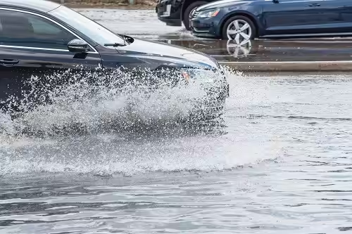
The nickname is more than trivia. It describes a real pattern of geography and weather that shapes how quickly a creek can leave its banks, how little warning people may get, and why so many families are surprised to learn their homeowners or renters policy does not pay for rising water. Understanding the pattern helps you ask better questions before a storm, not after one.
Flood maps, elevations, and policy terms vary by address. Check official flood-map resources and talk with an agent about options for your property.
1. Where “Flash Flood Alley” sits
When forecasters and emergency managers talk about Flash Flood Alley, they are usually describing a band of Central Texas where the land drops sharply from the Hill Country toward lower ground and the river systems that eventually drain to the Gulf. The shape of the land, the type of rock under it, and the way storms behave there combine to make sudden flooding more common and more dangerous than in many other places.
- Central Texas focus — The nickname is most often tied to the Texas Hill Country and connected river systems draining toward the Gulf, not every coastal bayou or every Panhandle creek equally.
- Terrain matters — Hills, canyons, and abrupt elevation changes funnel runoff into creeks and dry washes that can become torrents after intense rain.
- Limestone & thin soils — Much of the Hill Country sits on karst limestone with limited soil depth, so water runs off quickly instead of soaking in.
Each of those three features makes the others worse. Steep hills move water downhill quickly. Thin soil over limestone cannot hold much of it, so more of the rain becomes runoff. Narrow creeks and dry washes then collect that runoff and concentrate it into a fast-moving surge. A stream bed that looks harmless and nearly dry on a sunny afternoon can carry a wall of water a few hours after heavy rain falls upstream, sometimes miles away from where you are standing.
2. Why floods here can develop so fast
Speed is what separates a flash flood from a slow river rise. In a slow rise, water climbs over days and people have time to move vehicles, belongings, and family members. In a flash flood, the gap between the rain and the dangerous water can be measured in hours or less, which is why low-water crossings, campgrounds, and homes near creeks deserve special attention.
Rainfall intensity
Slow-moving storms and tropical moisture can dump heavy rain in short windows. When upstream basins saturate, downstream rises can outpace evacuation time.
Watershed response
Steep catchments shrink the lag between rainfall and creek rise. Low-water crossings and campgrounds near scenic rivers are historically hazardous in these conditions.
| Factor | Flood implication |
|---|---|
| Steep Hill Country relief | Fast runoff into narrow channels |
| Thin soils / limestone | Less absorption; more surface flow |
| Urban growth in basins | More impervious cover can speed peak flows in some watersheds |
| River recreation corridors | Visitors and residents near scenic waterways face sudden stage rises |
Read the table as a list of reasons the same amount of rain can produce very different results in different places. Steep terrain and thin soil send water downhill quickly. Growth in a watershed replaces fields with roofs, roads, and parking lots that shed water instead of absorbing it, which can speed up peak flows in some basins. Recreation corridors put people right beside the channels that rise first. None of these factors on its own predicts damage at a particular address, but together they explain why the region earned its reputation.
3. Flood risk is not only “Flash Flood Alley”
It would be a mistake to think flood is only a Hill Country problem. Texas floods in several different ways, and each one has its own cause. Coastal flooding is driven by tropical storms, storm surge, and very heavy rain over flat ground. City flooding often happens when storm drains and streets simply cannot carry the water away fast enough. Rural creeks can rise in almost any part of the state after a stalled storm.
- Gulf Coast & bayous — Hurricane and tropical-rain flooding affect Houston, Galveston, and other coastal communities for different physical reasons. Season context: when is hurricane season in Texas?
- Urban flash flooding — Cities statewide can pond water when drainage is overwhelmed—even outside classic Hill Country nicknames.
- Map vs. reality — Properties outside a high-risk mapped zone can still flood. Maps are tools, not guarantees. Practical guide: flood maps by address for Texans.
The practical lesson is that the nickname describes one well-known pattern, not the boundary of flood risk. A household in Houston, Dallas, San Antonio, or a small town far from the Hill Country still benefits from looking up its own flood map information, asking neighbors about past water, and thinking about whether the home or apartment has ever had water in it during heavy rain.
4. The insurance angle: flood usually is not on homeowners
This is the part that surprises many Texans. A standard homeowners policy is designed around sudden events such as fire, wind, hail, and theft. Water that rises from the ground up, overflows from a creek or river, or flows across the surface of the land is usually treated as flood, and flood is usually excluded. The exact wording varies by policy form, so the declarations page and the policy itself are the final word for your home.
- Standard homeowners policies — Typically exclude flood (surface water, overflow of inland or tidal waters, and related water movement as defined in the form). Wind-driven rain through a storm-damaged opening is a different analysis than flood.
- Separate flood coverage — Flood protection is commonly arranged through the National Flood Insurance Program and/or private flood markets, subject to eligibility and underwriting.
- Renters too — Contents flood exposure for apartments near creeks or in mapped zones is also separate from a standard renters policy.
Timing matters too. Flood coverage through the National Flood Insurance Program generally has a waiting period before it takes effect, so buying a policy when a storm is already in the forecast may be too late for that storm. Private flood markets have their own rules. The safest approach is to make the flood decision during a calm stretch of weather, when you can compare options without pressure, and to review it each year at renewal.
Start here: flood insurance in Texas · deeper overview: comprehensive Texas flood insurance guide · Texas flood insurance · second-home National Flood Insurance Program questions: does Federal Emergency Management Agency flood cover second homes?
A few numbers make this concrete. A new National Flood Insurance Program policy normally starts 30 days after you buy it. The main exceptions are buying it while making, increasing, extending, or renewing a mortgage (no wait) and buying within 12 months after a map update newly puts the home in a high-risk zone (a one-day wait) (FloodSmart). The policy pays up to $250,000 for a home’s building and up to $100,000 for belongings (FloodSmart). Prices come from FEMA’s Risk Rating 2.0, which since April 2023 has weighed each property’s distance to creeks, rivers, and other water, its elevation, the kinds of flooding seen there (including heavy rainfall), and the cost to rebuild, instead of relying mainly on the flood zone (FEMA).
5. Practical steps for Texas households near flood-prone terrain
If you rent, the same thinking applies to your belongings. Your landlord’s policy is written to protect the building, not your furniture, clothing, electronics, or car. A renter near a creek or in a mapped flood zone can look at flood coverage for contents only, which is often a smaller and simpler decision than insuring an entire structure. Whether you own or rent, keep digital copies of important documents and photos of your belongings somewhere other than the home itself.
The steps below are simple, but they work best when they are done before the rainy season rather than in the middle of a warning. Think of them as a short annual checkup that covers both your safety plan and your insurance paperwork.
- Look up your address on current flood-map tools and note zone, elevation, and any local drainage issues.
- Ask whether your mortgage requires flood insurance—and whether optional coverage still makes sense if it does not.
- Review your homeowners or renters declarations for water exclusions; do not assume “storm damage” equals flood.
- Document belongings and know evacuation routes for low-water crossings.
- Talk with an independent agent about National Flood Insurance Program vs. private flood options for your structure and contents.
Why flood losses vary: Flood severity depends on depth, velocity, duration, and what was in the building.
The bottom line is that Flash Flood Alley is a reminder of how fast water can move in Texas, and that speed is exactly why flood decisions should be made ahead of time. Know your address, know what your current policy says about water, and decide deliberately whether separate flood coverage belongs in your plan.
Frequently asked questions
What is Flash Flood Alley?
A common nickname for parts of Central Texas—especially Hill Country river basins—known for rapid-onset flooding driven by terrain, soils, and intense rainfall. The term is informal and is not an official insurance or map designation, so your flood map information and policy documents still matter more than the nickname.
Does homeowners insurance cover flash floods in Texas?
Generally no. Flood is typically excluded from standard homeowners forms. Separate flood coverage is the usual path—confirm with your declarations and an agent. Wind-driven rain that enters through a storm-damaged roof or window is analyzed differently, so describe exactly how water entered the home when you report any loss.
If I am not in a high-risk flood zone, am I safe?
Not necessarily. Maps change, and flooding can occur outside high-risk designations. Evaluate local drainage, elevation, and prior events near your address. Many flood claims come from properties outside the highest-risk mapped areas, which is why a lower-risk designation is a reason to compare options rather than a reason to stop thinking about flood.
Is this a weather forecast or engineering study?
No—educational geography and insurance context only. For official warnings, use National Weather Service and local emergency management sources. During active weather, follow official warnings and never drive into water covering a road, because the depth and current are impossible to judge from behind the wheel.